Upper Mustang Trek
16 Days
3780m

Easy
The Upper Mustang Trek is an extraordinary adventure that takes you into the remote and enchanting region of Mustang, located in the Trans-Himalayan region of Nepal. Often referred to as the "Forbidden Kingdom," Upper Mustang is a restricted area that was only opened to foreigners in 1992, making it a truly hidden gem for trekkers seeking a unique and untouched experience.
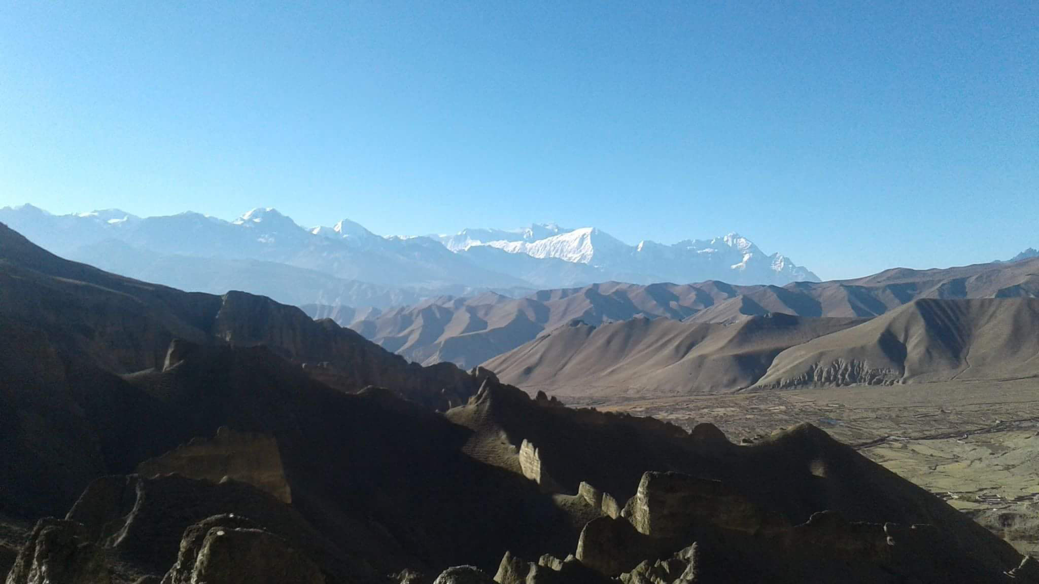
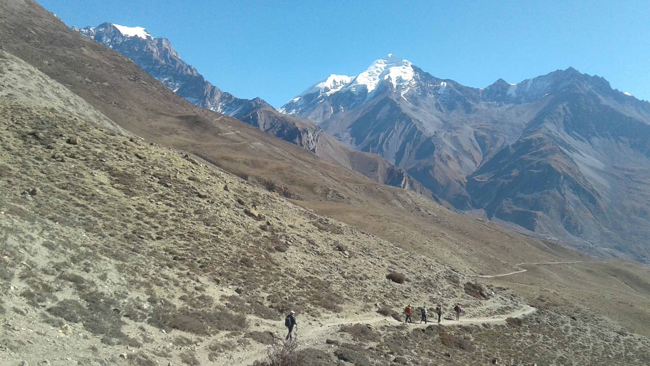
This captivating trek is renowned for its stark and surreal landscapes, resembling a desert-like terrain with its arid valleys, towering cliffs, and fascinating rock formations. As you embark on this journey, you will be greeted by panoramic views of snow-capped peaks, including the mighty Annapurna and Dhaulagiri ranges, adding a majestic backdrop to the already mesmerizing scenery.
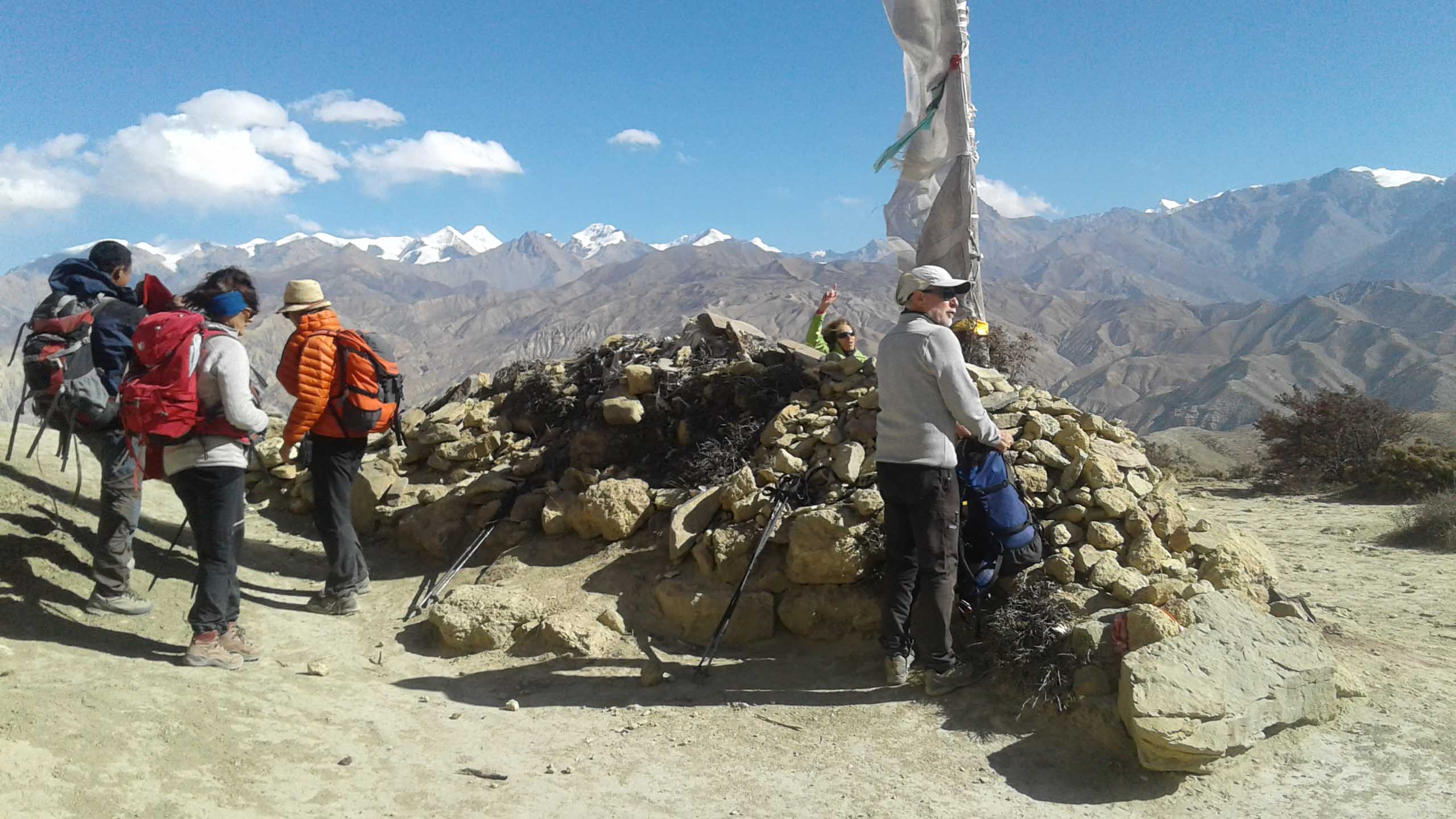
The cultural aspect of the Upper Mustang Trek is equally captivating. The region has preserved its Tibetan Buddhist heritage for centuries, and you will encounter ancient monasteries, intricately carved mani walls, and prayer flags fluttering in the wind. The fortified city of Lo Manthang, with its white-washed mud-brick houses and a royal palace, serves as the cultural centerpiece of the region and offers a glimpse into the ancient kingdom's rich history.
The trek typically begins with a scenic flight from Pokhara to Jomsom, where you start your walk towards Kagbeni, a charming village on the banks of the Kali Gandaki River. From there, you follow the Kali Gandaki Valley, passing through picturesque settlements, such as Chele, Syangboche, and Tsarang, each offering their unique cultural and natural beauty. The trails lead you through narrow canyons, across suspension bridges, and up steep ascents, rewarding you with breathtaking vistas at every turn.
One of the highlights of the Upper Mustang Trek is the journey to the sacred pilgrimage site of Muktinath, where Hindu and Buddhist devotees flock to pay homage to the revered temple. The spiritual atmosphere and the panoramic views from this vantage point create a profound sense of awe and tranquility.
Due to its remote location, the Upper Mustang region has been able to preserve its natural beauty and traditional way of life, providing trekkers with an authentic and off-the-beaten-path experience. The trek is generally done in 12-15 days, allowing ample time for acclimatization and exploration of the fascinating surroundings.
Overall, the Upper Mustang Trek is a captivating journey that combines the raw beauty of the Himalayas with the rich cultural heritage of Mustang. It offers an opportunity to step back in time, immerse yourself in an ancient kingdom's traditions, and witness the awe-inspiring landscapes that have remained untouched by modern development.
Includes and excludes :
Includes:
- All meals as specified for trek (breakfast, lunch, dinner with tea/coffee).
- Arrival pick up & departure.
- All internal local transport as per the itinerary.
- Internal flights
- All trekking arrangements including trekking permits, climbing permits, National Park entrance fees.
- Accommodation in twin sharing local lodges or best available places for accommodation,
- Trekking & Climbing leader & porter (salary, insurance, food, accommodation & other allowances).
- Basic first aid kit is carried by your leader.
- All hard ware gears
Excludes:
- Kathmandu food lunch & dinner,
- International flights to Kathmandu,
- Tips for Porter, guide & other
- Personal climbing gears and climbing boot, clothing & equipment
- Personal expenditure, all bar bills, laundry, telephone calls, hot shower in the mountain region, mineral water, snacks, desserts.
- Medical examination (if required) & vaccination costs
- Optional trips. Charges incurred as a result of delays beyond our control
- Visa fees & Travel insurance. Airport taxes
- Meals or drinks except the 3 main meals specified in itinerary
- Anything else not specified in the ‘included costs’ section above
For more details
Itinerary breakdown
Upper Mustang Trek
DAY 01: ARRIVE KATHMANDU.
DAY 02: FLY or DRIVE TO POKHARA – 30 mins flight
Day 03: FLY JOMSOM & trek to Kagbeni {2810m} – 3-4 hrs walk – O/N teahouse lodge..
DAY 04: TREK TO CHUKSANG. (2,920m) approx. 6 hrs walk
DAY 05: TREK TO SAMAR. (3,290m) approx. 6-7 hrs walk
DAY 06: TREK TO GHILING. (3,600m) approx. 6 -7 hrs walk
DAY 07: TREK TSARANG (3,520m) approx. 6-7 hrs walk.
DAY 08: Trek to LO MANTHANG (3,780m) the capital of Mustang – approx. 4-5 hrs walk.
DAY 09: A day for Rest & some local excursions of LO MANTHANG.
DAY 10: Trek to GHAMI 3,440m approx. 6-7 hrs walk
DAY 11: Trek to SAMAR. 4-5 hrs walk – O/N Camp
DAY 12: Trek to YAK KHARKA. 3,845m – approx 5-6 hrs walk
DAY 13: Trek to MUKTINATH. (3,710m) approx. 4 hrs walk
DAY 14: Trek to JOMSOM {2713m} 3-4 hrs walk
DAY 15: Fly from JOMSOM to POKHARA & drive back to KATHMANDU
DAY 16: Transfer to Airport for your International departure.


